The Airport Employment Growth District (AEGD)
What is the AEGD?
The headwaters of the creeks and streams that make Hamilton the ‘City of Waterfalls’ are found on the Hamilton Mountain, much of it within the Airport Employment Growth District (AEGD).
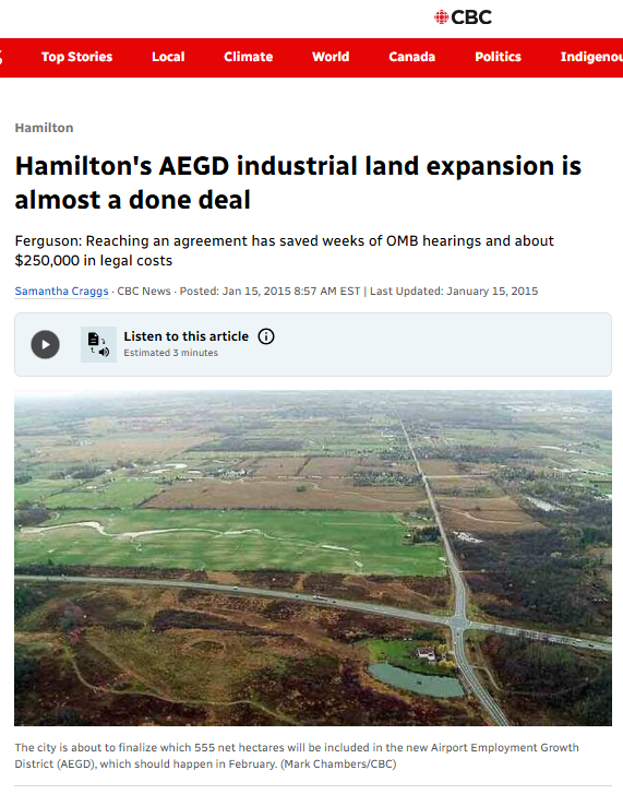
The AEGD is an industrial/institutional zone that was approved by Council on October 13, 2010 and came into effect on February 3, 2015, after a decision from the Ontario Municipal Board (now known as the Ontario Land Tribunal). This 1300 acres of prime agricultural farmland, wildlife habitat, wetlands and headwater tributaries south of Garner Rd, Rymal Rd and Twenty Rd are now all under threat of destruction by industrial warehouse developments. As of late 2025 there are around a dozen active industrial warehouse applications that have already been approved or are in the works. All of them threaten our headwaters.
The Airport Employment Growth district rezoning was finalized in 2015 when the urban boundary of Hamilton was expanded and 1300 acres of prime agricultural land, headwaters and wildlife habitat north and east of the Hamilton Airport was rezoned from “Agricultural” to “Industrial” and “Institutional”. This rezoning now permits industrial developments such as warehousing or manufacturing to be built on prime farmland and sensitive natural areas. The AEGD is also the highest point of land between Lake Erie and Lake Ontario and so forms the headwaters of many of the creeks and streams flowing over the escarpment the Hamilton area. These headwaters, wetlands, springs and groundwater recharge areas are all at risk of destruction at the hands of industrial sprawl in the AEGD.
The City of Hamilton’s AEGD webpage is HERE
History of the AEGD
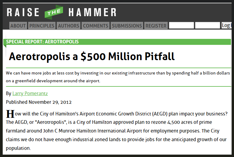
The AEGD was originally known as the “Aerotropolis”, an idea floated about 2001 by local boosters and the private company that secured a 40 year management contract for the airport in 1996. The “idea” was that airports were becoming the new centers of economic development in the way that railways or ports or highways have been considered at various points in the past. At one time, cities with large ocean ports were the most economically active, for example, but the aerotropolis advocates claimed that future success would be centered on airports.
About 2002, the newly amalgamated City of Hamilton embarked on what they called GRIDS (Growth Related Integrated Development Strategy) which mainly focused on expanding the urban area by as much land as possible. These expansions are usually focused on new residential lands, but Hamilton’s population growth was so slow, this could not be justified. This was especially true when the Liberals took over Queens Park with plans to control sprawl. In 2005, they introduced the Greenbelt Plan, as well as the Growth Plan for the Greater Golden Horseshoe that set rules on when municipalities could expand their urban boundaries. It was clear that sprawl was becoming much more difficult, so part of Hamilton’s “answer” was the aerotropolis – an expansion allegedly required to provide for sufficient employment (formerly known as industrial zoning). At the same time, GRIDS was to determine where future residential growth would happen.
Urban Boundary Expansion
Around 2005, six potential growth plans were presented for public consultation. All six included a huge boundary expansion around the airport for employment lands. The differences in the six draft plans was where future residential growth would take place and this is where Elfrida was selected as the number one choice. The city tried to “earmark” Elfrida as a “future growth area” – a step that the Liberal Provincial government said was not allowed. The province understood that as soon as an area was earmarked for growth, the end of its agricultural use was sealed and farms within that area would be compromised by being ‘mined’ (for sod farms for example) or snapped up by land speculators. Soil fertility and agricultural sustainability would be compromised.
Despite the provincial warnings against earmarking, the majority of city council members of the time approved a new official plan in 2009 that earmarked Elfrida as a future growth area. The provincial government makes the final decision on municipal official plans (OP) and in 2011 it came back with a modified OP that excluded references to the Elfrida future growth area. The Elfrida landowners filed an OMB appeal against this official plan and convinced a council majority to make the city a joint appellant.
Hamiltonians have been fighting urban expansion for decades
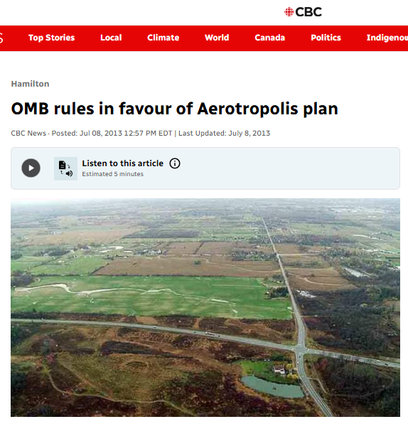
There was a lot of public opposition to the formation of the aerotropolis – sufficient that the city changed its name to AEGD – led by Environment Hamilton and a new group called Hamiltonians for Progressive Development (HPD). There was also push back from provincial planners on the proposed size of the AEGD. The combination of public and provincial pressure whittled down the size of the AEGD from the original proposal. Both Environment Hamilton and HPD appealed the city’s plans but the OMB eventually approved an AEGD of 551 net hectares of developable land (695 gross hectares) in 2014.
It then oversaw a drawing of the boundaries that was finalized in 2015. In this latter process the Twenty Road West landowners got their properties excluded from the AEGD and left as rural islands surrounded by the urban area that now included the AEGD lands. In that process, behind closed doors, there were some lands added to the AEGD to make up for what was removed for the Twenty Road West landowners group.
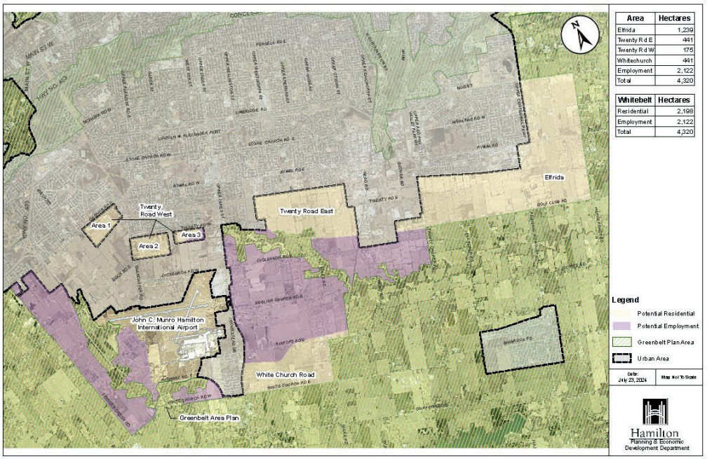
The final settlement also committed the city to launch a new Municipal Comprehensive Review to determine where the boundary should be expanded for residential development. That’s the current MCR/GRIDS2 that began in 2017. This commitment was demanded by the Twenty Road West landowners who saw it as a way to get their rural islands converted to new residential subdivisions. The agreement, however, stated that the city saw Elfrida as its number one choice, the Twenty Road East lands as its second choice.
Location
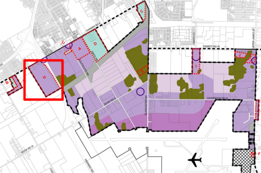
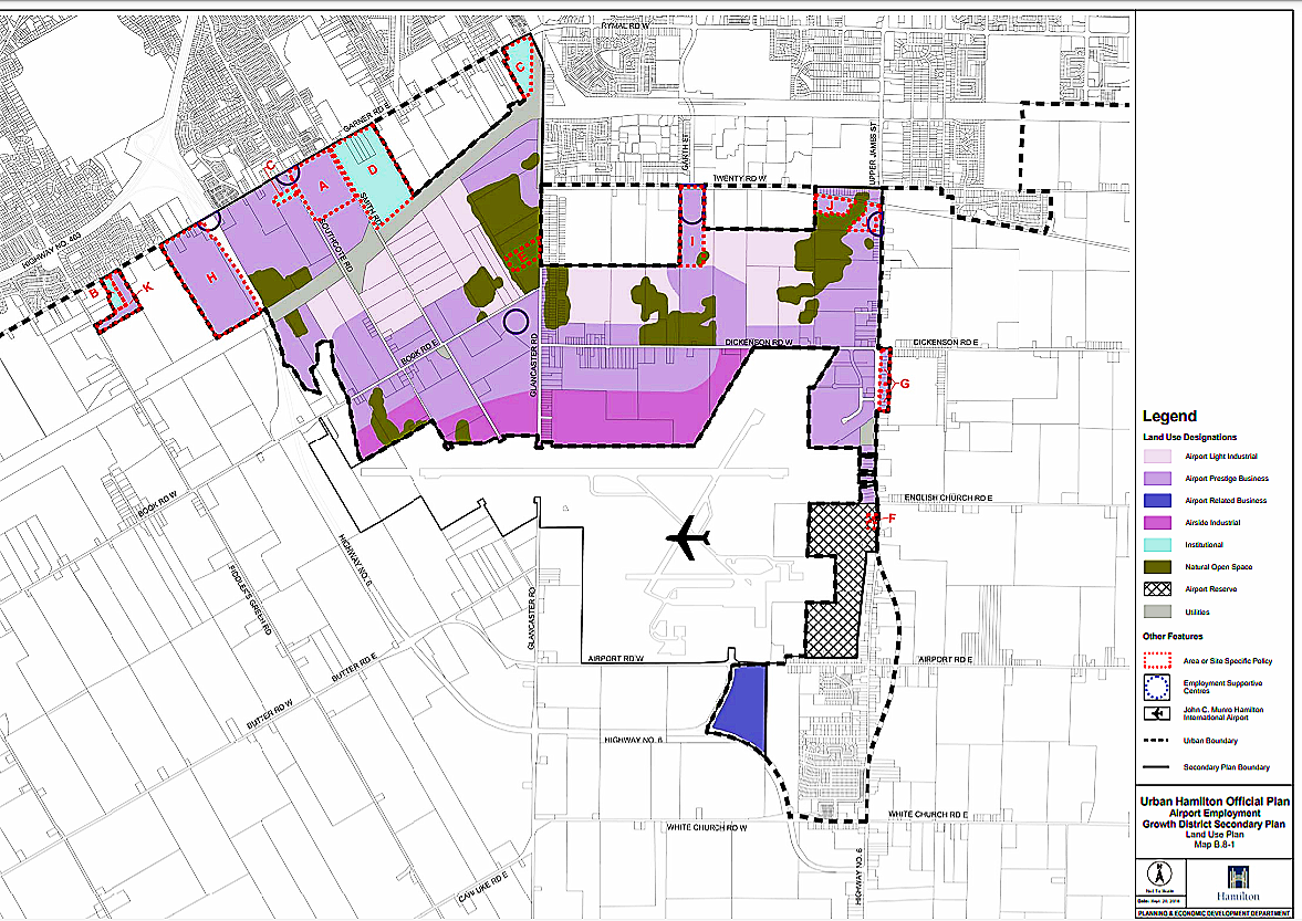
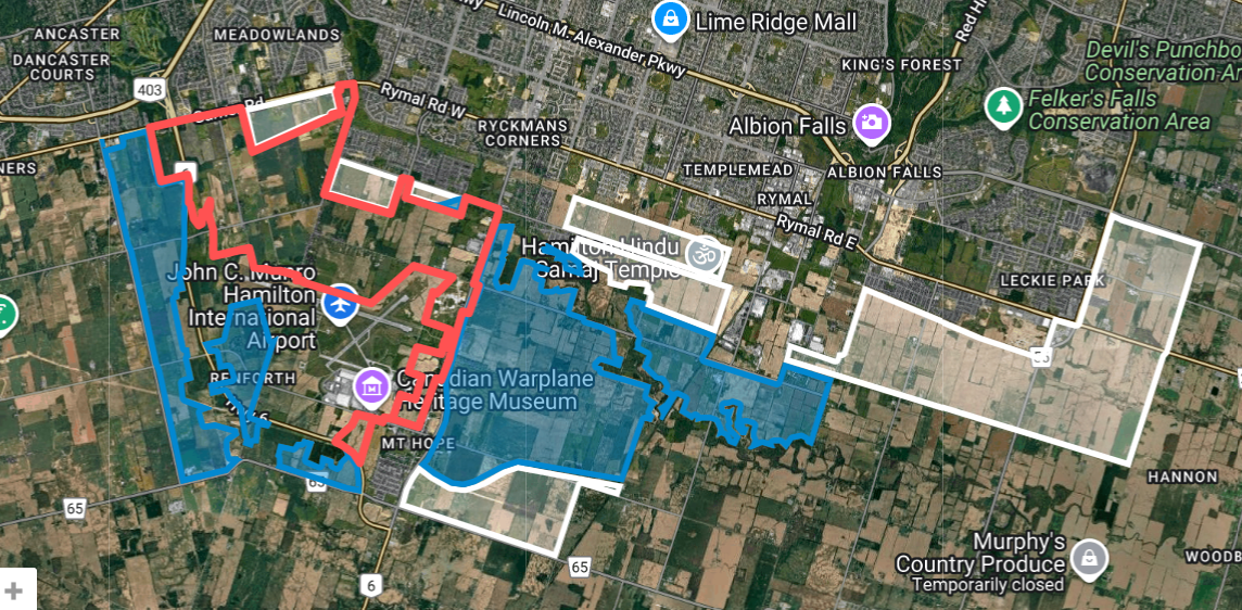
The AEGD is located south and west of the residential white belt lands that were the subject of recent urban boundary expansion attempts by land speculator developers. The map shows:
Red outline - AEGD
White - White belt contested urban expansion areas - residential
Blue - White belt potential urban expansion - non-residential (due to airport proximity)
AEGD and the recent Urban Boundary Expansion fight
Having already been brought into the urban boundary in 2015, the AEGD is not part of the most recent (2021) attempt at urban boundary expansion (UBE) into the “white belt” lands that Hamiltonians fought against - and won. On Nov 9, 2021 the majority of City Council voted to change course on residential sprawl by freezing Hamilton’s urban boundary and focusing instead on urban renewal and rezoning to permit adding housing density to existing neighbourhoods close to jobs, transit and amenities.
This firm urban boundary decision still holds although Doug Ford’s Conservatives have changed the provincial rules to now allow land speculator landowners to challenge municipalities’ growth plans at the Ontario Land Tribunal. As a result, there are now five appeals to the OLT attempting to force the expansion of Hamilton’s firm urban boundary. Land speculators hope to build McMansions on prime farmland, floodplains, wetlands and habitat, but Hamiltonians and City Council continue to resist.
Learn more at Stop Sprawl HamOnt and at the City’s Urban Boundary webpage.
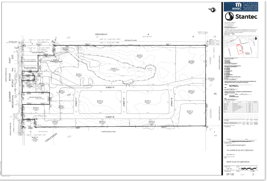
The Garner Marsh is just one of dozens of threatened wetlands in the AEGD
The Garner Marsh is located at 140 Garner Rd East and labeled with “H”. The property is 89 acres of prime farmland and the wetland is situated to the east side. Until recently, it was surrounded by fields of tomatoes, sunflowers, horseradish, pumpkins and poppies, all farmed by local Ancaster farmers who have since vacated for other areas of the province with protected agricultural land. There are also three woodland communities on the property that support several species at risk. Important to note is that even if the Marsh is saved the farmland here is slated to be paved for warehouses. Whether warehouses or houses, sprawl is steadily eating away at our prime farmland, headwaters and habitat.